
UM RUS PROJECT
UM RUS
The Nubian Mining Company (NMC) has been granted the exploration license for the Um Rus block because of its participation in the international Bid-Round 1/2020, which was led by the Ministry of Petroleum and the Egyptian Mineral Resource Authority (EMRA). This license allows NMC to explore for gold and associated minerals in the highly prospective Eastern Desert region of Egypt.
Location and Access
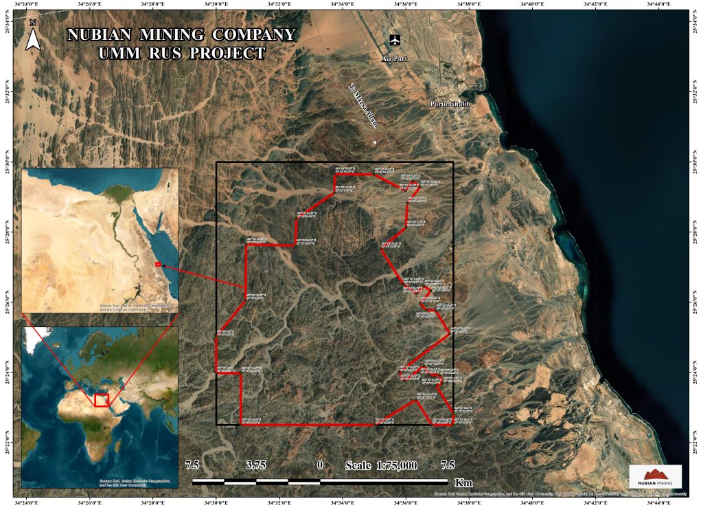
The Umm Rus project is situated in the Central Eastern Desert, specifically around 52km northwest of Marsa Alam and approximately 13km south of the Marsa Alam airport. The project area measures approximately 12.5km by 13.8km, covering an area of 175km². However, as per the exploration agreement, the company is required to relinquish 20% of the original area after the initial two years of exploration.
The project is located along the Red Sea coastline and is entirely within a 20km distance from the coast. In the northern part of the block, there is the historic underground Um Rus Gold Mine, which is situated within the Um Rus Granitoid Pluton. The mine was last active in the early 1900s, indicating a historical presence of gold mining in the area.
Background
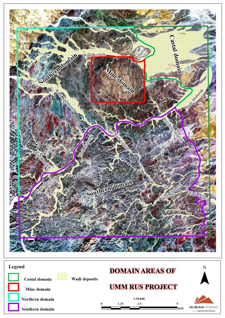
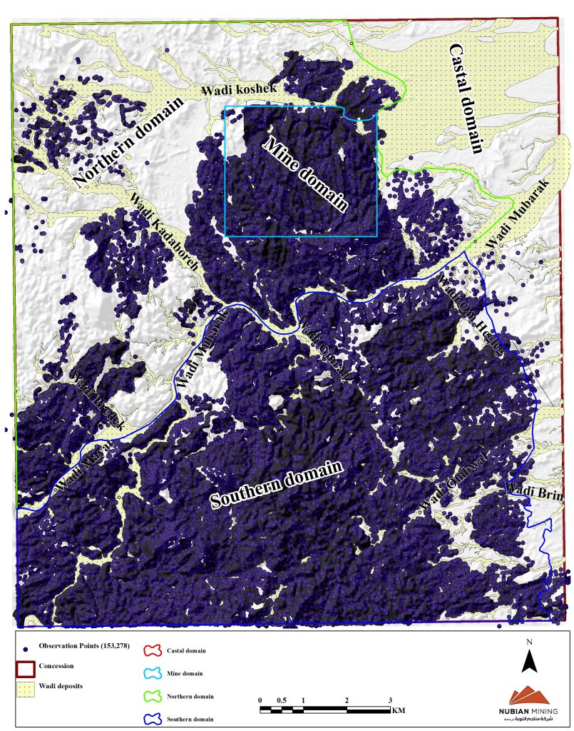
- The Um Rus pluton (Mine Domain): This domain is characterized by a dominant granodiorite intrusion and is in the northern extent of the concession area.
- The Northern Domain: This domain includes areas located north of the Wadi Mubarak but outside of the Granodiorite intrusion.
- The Southern Domain: This domain is situated south of the Wadi Mubarak.
- The Coastal Domain: This domain represents the low land area incorporated in the Red Sea rift and is covered by Phanerozoic Sediments.
Geology
The Um Rus Project is situated within the Wadi Mubarak structural belt, which forms a 65 km long and 20 km wide, E-W striking zone of variably deformed volcanic metasediments within the Central Eastern Egyptian Desert. • The Central Eastern Desert is characterized by a classic granite greenstone terrane, i.e. a series of high-grade metamorphic core and granitoid intrusions surrounded by anastomosing low-grade volcano-sedimentary rock.
Infrastructure and Constructions
NMC has successfully built an advanced and robust camp that is reliable, easy to mobilize, maintain, and demobilize. This camp provides high-quality mining camp services, including accommodation for both permanent and temporary mine workforce. The camp offers conveniences such as sleeping quarters, kitchen facilities, laundry, and even a soccer pitch for recreational activities. Additionally, maintenance services are available to ensure the smooth operation of the camp.
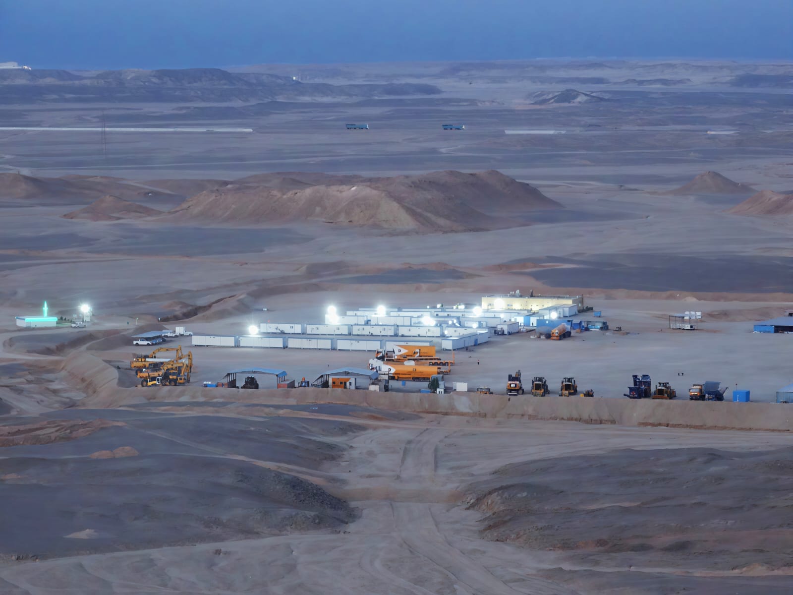
To facilitate mobilization to various target areas, ISK has constructed several access roads. This enables efficient movement of personnel and equipment to different locations within the concession area. Furthermore, ISK has provided excavation services for drill pads and trenching, which are essential for the NMC technical team to carry out their exploration activities effectively.
Gold Mineralization Styles
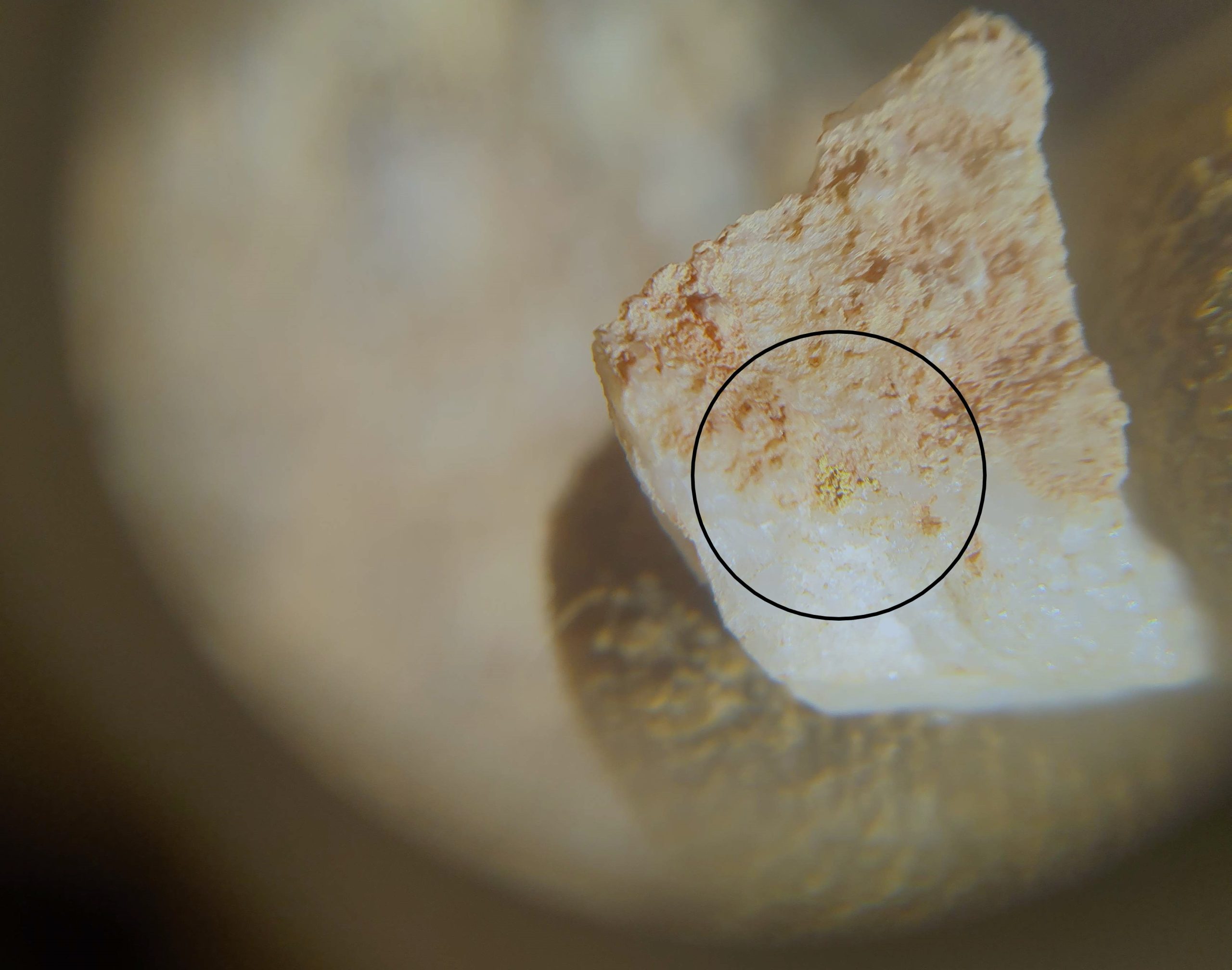
The mineralization identified within the Umm Rus Tender Block is primarily in the style of an orogenic gold deposit, which is the main target for future exploration efforts. However, there is also a possibility of volcanic-hosted massive sulphide (VMS or VHMS) style mineralization in the block, which will be taken into consideration in future exploration programs.
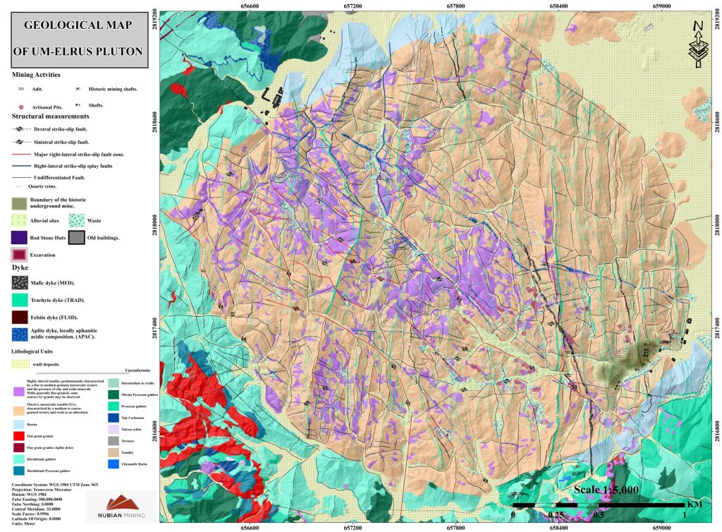
The Um Rus area is known for its potential to host various mineral deposit types that are typically found in accreted terrain rocks and orogenic-related intrusive. In the concession area, the Umm Rus granite is observed as two phases of intrusion.
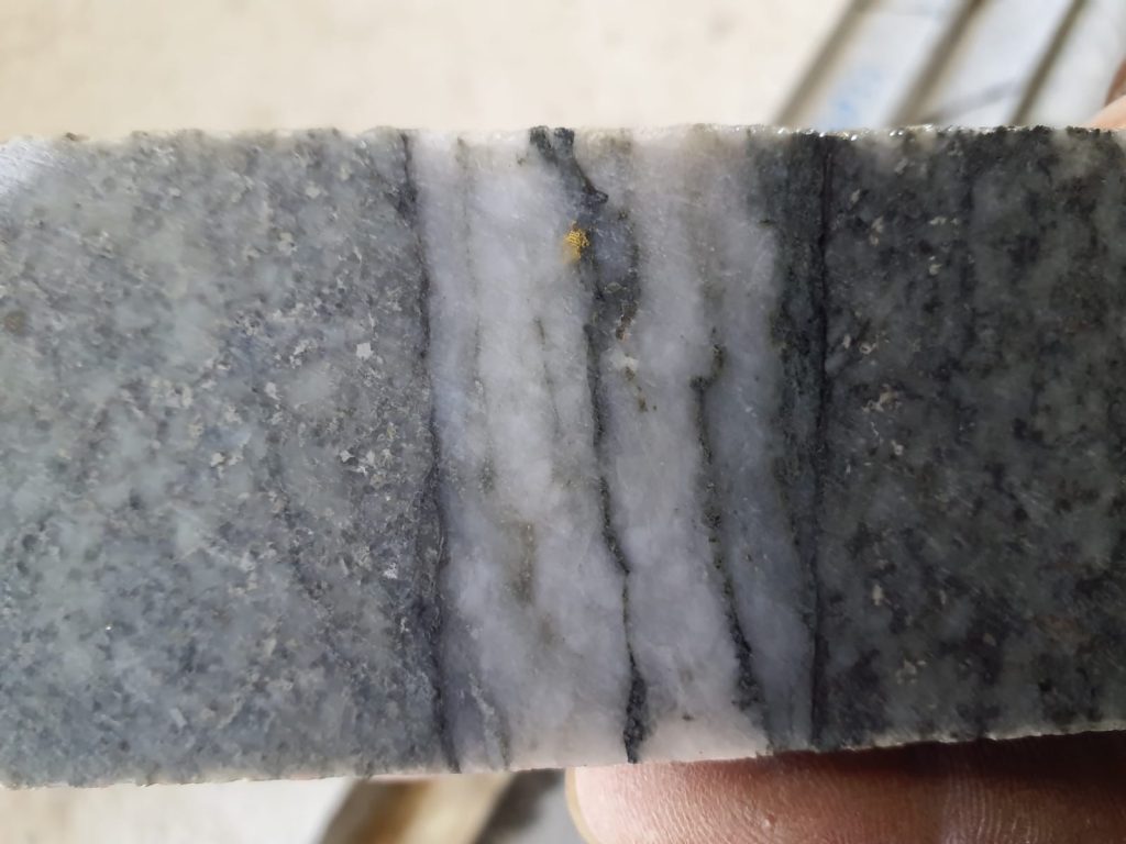
The first phase consists of medium to coarse-grained tonalite-granodiorite, predominantly mesocratic rocks (Phase 1). The second phase represents the residual melt of the pluton, intruding the first phase as stocks, dykes, and sills (Phase 2).
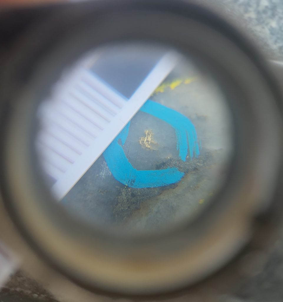
The Phase 2 intrusion is primarily composed of fine-grained, leucocratic rocks and exhibits significant mineralization in certain areas.
Exploration of the concession area
NMC has conducted an extensive exploration program in the entire concession area, utilizing various levels of exploration techniques such as regional reconnaissance, trenching, RC drilling, and core drilling. This program has been carried out simultaneously across different areas. Based on the available data, NMC has established a list of priorities, with the Umm Rus Pluton being at the top. This area is considered to have the most significant potential, with six important prospects identified. However, exploration work is also ongoing in the remaining parts of the concession.
The Mine domain consists of tonalite- granodiorite- diorite- gabbro association and covers about 9km² and contains in addition to the Umm Rus historic mine, tens of old and recent artisanal workings.
Mapping and sampling
During the exploration process, the regional mapping reconnaissance phase has been conducted, followed by detailed mapping at various scales. The focus of these mapping activities has been to document and record important features such as artisanal mine sites, shear zones, quartz veins, structural elements, and lithology. This comprehensive mapping effort has covered almost the entire concession area. As a result, a total of 157,601 observation points has been recorded thus far, providing valuable data for further analysis and decision-making.
Drilling Programs
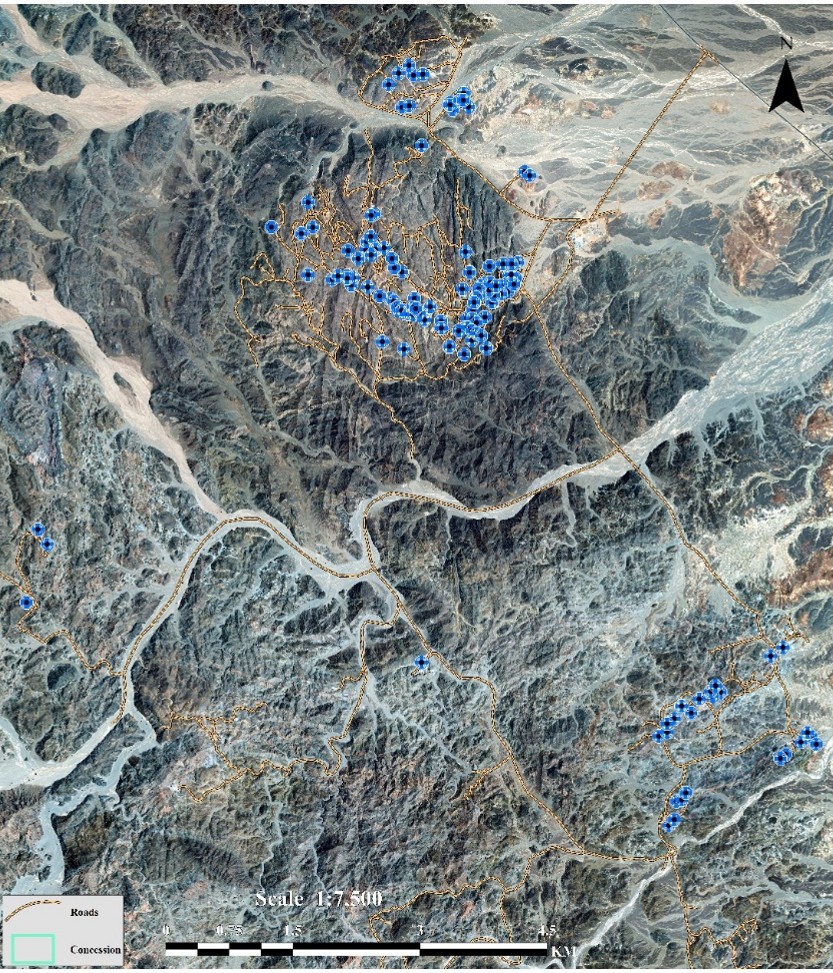
MNC conducted a considerable exploration drilling program including RC and core at the concession area.
RC Drilling Methodology
The RC exploration drilling program commenced in April 2022 and completed 301bore holes with total depth of 46,652m. The program is designed to test the continuity of gold with depth.
NMC utilizes dual wall drill rods that consist of an inner and outer tube. The inner tube allows the drill cuttings to be transported to the surface in a continuous, steady flow. This method also reduces the risk of contamination with rock chip samples being representative of the drilled meter. Drilling is driven by a pneumatic hammer drill that crushes the rock and compressed air returns the drill cuttings through the inner tube. The drill cuttings travel around the cyclone and pass through a splitter attachment. The attached riffle splitter allows for sampling of approximately 3kg-4kg of material for assay analysis directly from the drill rig. NMC use drilling contractor ISK and the Explorac 100 drill rig. Explorac 100 is a crawler-mounted, compact rig specifically designed for reverse-circulation drilling at depths down to 250m with a remote-controlled rod handler and magazine that holds up to 30 drill pipes (3m length).
NMC, utilizing the services of drilling contractor ISK and the Explorac 100 drill rig. The Explorac 100 is a compact rig mounted on a crawler, specifically designed for reverse-circulation drilling at depths of up to 250m. It features a remote-controlled rod handler and a magazine capable of holding up to 30 drill pipes, each measuring 3m in length.
NMC, utilizing the services of drilling contractor ISK and the Explorac 100 drill rig. The Explorac 100 is a compact rig mounted on a crawler, specifically designed for reverse-circulation drilling at depths of up to 250m. It features a remote-controlled rod handler and a magazine capable of holding up to 30 drill pipes, each measuring 3m in length.
Diamond Drilling
Diamond drilling began on May the 7th utilising two drilling rigs. NMC uses drilling contractor ISK and the CHRISTENSEN 140 drill rig. NMC utilized PQ (85mm), HQ (63.5mm), and NQ (47.6mm) core sizes, like the RC rig.
The core drilling program has successfully completed 475 bore holes so far, with a total depth of 91,350.6 meters. NMC’s drilling strategy involved a series of consecutive drilling programs. It began with sparse exploration drilling in various target areas, followed by evaluating the results at specific prospects. The first stage of diamond drilling was then conducted on a grid covering an area 1069 meters long and 800 meters wide. The objective of this drilling plan was to test the continuity of mineralization outside the old mine.
The mineralization zone at the historic Umm Rus Mine primarily strikes in a NE-SW direction, dipping NW. The diamond drilling plan aimed to intersect this zone, but certain places were also tested along the NW-SE trend. In the old mine area, a total of 21 bore holes have been completed, and the overall results have been promising. These positive outcomes have encouraged NMC to consider implementing an infill bore holes plan.
Trenches
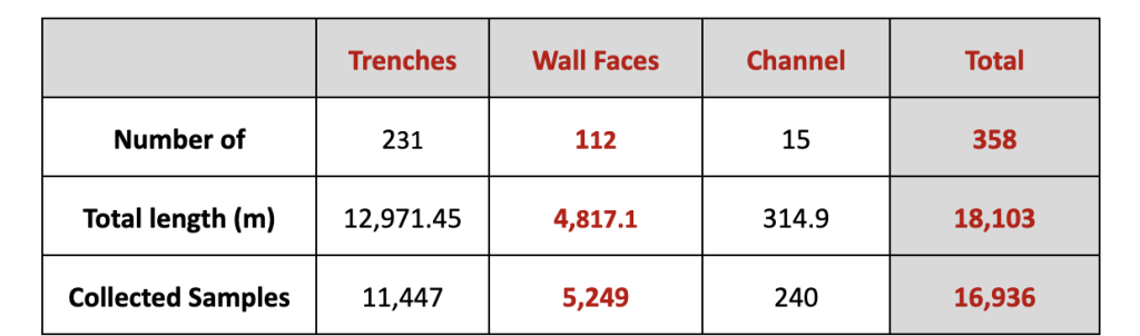
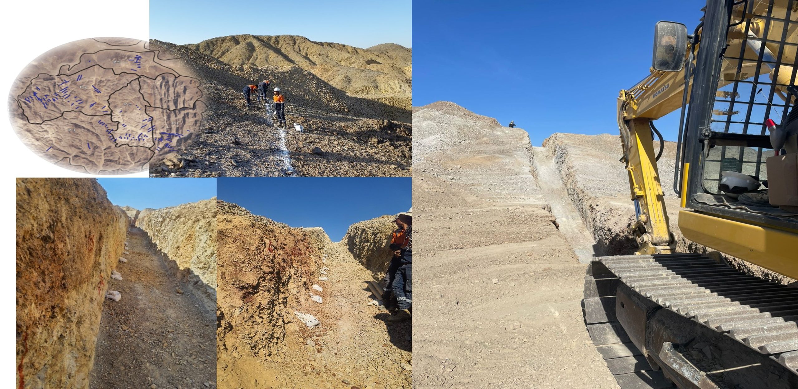
NMC has excavated approximately 181 trenches, wall faces, and channels as part of the exploration efforts. These excavations serve the purpose of testing the continuity of mineralization and obtaining detailed structural measurements in 2D.
The locations of these trenches were justified based on several factors:
- Promising anomalies obtained from surface grab samples assays: Positive results from surface grab samples indicated the presence of mineralization in certain areas, prompting further investigation through trenching.
- Location of artisanal work sites or extensions: If there were existing artisanal mining activities or extensions of known mineralized areas, NMC considered these locations as potential targets for trenching.
- Identification of criteria related to hydrothermal alteration: Hydrothermal alteration, which can indicate the presence of mineralization, was taken into account when selecting trenching locations.
- Geological similarity with known anomalous areas: If certain areas showed geological similarities to known anomalous areas, NMC considered them as potential targets for trenching to assess their mineralization potential.
- Testing the mineralized leucocratic fine-grained granite (aplite): Trenching was conducted to specifically test the mineralized leucocratic fine-grained granite, known as aplite, which is a target of interest for NMC.
By considering these factors, NMC aimed to strategically select trenching locations to gather valuable information about the continuity of mineralization and the detailed structure of the deposit.
Core Yard
At the NMC core yard, all drill core data is logged, processed, and stored. The core processing tasks are carried out in a specific order, which includes the following steps:
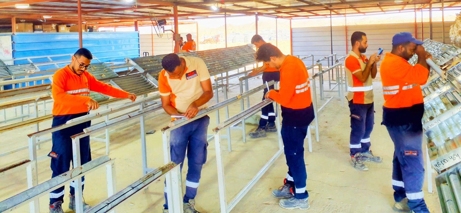
- Core Mark Up: Upon arrival in the core shed, the core is laid out on benches and reconstructed using V-rails. NMC geologists then mark the core by extending an orientation line from one core block to the next. They also mark the cutline, recovery and meter marks, and note any core losses.
- Core Logging: Core logging involves identifying the lithology, defining alteration types, style, and intensity, as well as identifying minerals present, including sulphide minerals. Geologists also record structural information, such as alpha and beta measurements, veining type, composition, style, and minerals infill.
- Sample Mark Up: The geologist responsible for logging defines and marks up the sampling intervals. These intervals typically range from a minimum of 30cm to a maximum of 100cm. If features of interest are below the minimum sample length, they are kept within the 30cm interval to minimize sample dilution. The drill core is aligned, and a cut line is drawn down the apex of foliation. Sample boundaries are marked on the core and box sides, and each sample is assigned a clear sample ID. Quality assurance and quality control (QAQC) samples are also inserted within the sample stream.
- Core Photography: Once the core has been reconstructed and marked up, it is laid out and photographed both in dry and wet conditions. This photographic documentation provides a visual record of the core.
- Density Measurements: In situ bulk density measurements, based on lithology as derived from the lithological log sheet, are collected. At least one measurement per core box is taken using approximately 20cm of drill core.
- Core Cutting: The core is cut along the marked cut line into two halves using a circular bench saw with diamond impregnated blades. The lower (right-hand side) of the core is sampled and placed in a clean steel tray along with other pieces from that sample. It is then bagged, weighed, and prepared for dispatch.
- Sampling: The right-hand side of the core is consistently sampled. The core segment is placed in a metal tray, and the full sample is composited. Once an entire sample has been cut, half of the core is transferred to a pre-marked sample bag with the corresponding sample ticket. The sample bags are sealed and securely stored in the core shed. Any unsampled core is returned to the core box and lay flat in its original position.
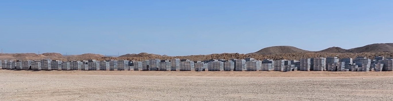
By following this systematic process, NMC ensures the proper handling, documentation, and sampling of the drill core, allowing for accurate analysis and interpretation of the collected data.
NMC has formulated plans for an extensive and costly drilling campaign. This campaign will involve drilling approximately 40,000 meters of exploration and bore holes at new targets. The aim is to further investigate these new areas based on the results obtained from previous work.
Additionally, NMC intends to conduct an infill campaign at Prospect 1 (P1) and Prospect 4 (P4). This infill drilling will help to gather more detailed information about mineralization in these specific areas.
By the end of 2024, NMC hopes to achieve a significant and economically viable reserve through these drilling efforts. This indicates their commitment to further exploration and the potential for future mining operations.